Fri Apr 11 2025 14:16:39 GMT+0000 (Coordinated Universal Time)
Anianta Landslide in Brief
Anianta spring-head valley has been there since time and since 1554 Arondizuogu vis-avis Ndianiche Uno was established, the Anianta spring-head valley has been existing and had served as major source of drinking water to the teeming population of the indigene of Ndianiche Uno and who else that care for clean drinking water. The main flow, the Anianta river was, is and would continue to be a major 'swimming pool' for the indigene and the river flow continue until it joined with yet another stream in the village, Anammiri and both flowed to Imo River.
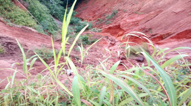
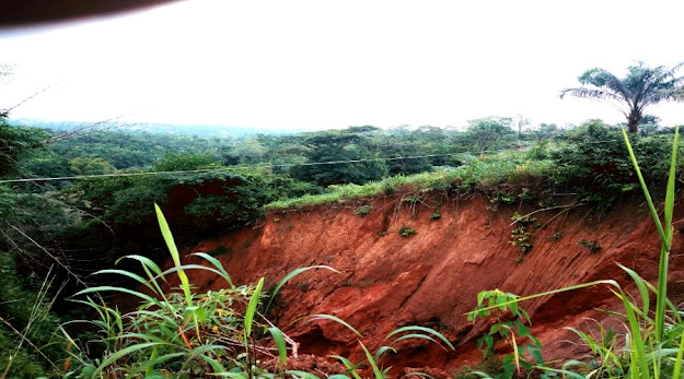
It was not until early 70s that some significant landslide activities started in and around the hub of the sloppy valley and promptly the village authorities reported it to the East Central State ECN. It was reported then that the government sent a team that planted several trees in and arround the valley and hill sides hopping that the plant roots would help to hold the gradually sliding earth. Apparently that held the the slide to a check up till late 80s and perhaps early 90s when it picked up in Ernest with a clear wide arrow head. Nearest farm lands and some houses and the road connecting Ndianiche Uno and Umuobom then were nearly 800 meters away but as I am typing now, all the farm lands are gone and it had eaten up the close to the road to the extent the gutter by its side has long fallen into the gully it has created. The locals actually did some commendable thing by trying to stave it of huge flooding conducted by the gutters by creating a diversion of the flood water about 30 meters from the landslide arrow head but the fact is that since the landslide has created the deepest gully to the surrounding landscape, the flood all find its way into it after all, though it would have been far more worse if the flood had hit the arrow head. However, for the very fact that water has started settling at the the road section directly opposite the arrow head it means that the earth has started cracking under the surface and so when it rains water sip into those cracks and since they had reached saturation point, the water remains on the surface helping the arrow head to soften the soil until the day it would do a sudden cascade and the road is washed away as the arrow head move even closer to peoples houses and in particular the only secondary school in the village and beyond.


No comments:
Post a Comment